TEL: 07979 812392
GPS Surveys
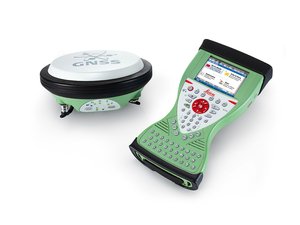
Hamilton Surveys Ltd invested in Leica GPS Technology over 7 years ago and regularly use this technology in our range of GPS surveying and setting out work throughout Scotland.
Leica's “all on one pole” system utilises the Leica / Ordnance Survey Active GPS Network correction service, smartnet
 Leica Viva GPS
which enables surveying in RTK (Real Time Kinematics) mode without the need for post processing survey data. This allows for the viewing of 3D coordinates as they are being recorded.
On sites where there is a clear sky view allowing maximum satellite usage, GPS is an excellent surveying tool.

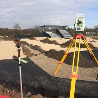
Where a site contains trees, buildings or other obstructions which would restrict the satellite availability, we would survey these areas traditionally with a total station.
With the number of available American GPS and Russian Glonass satellites increasing year on year, and the availability of the European gallileo satellites in the next few years, GPS will be used increasingly as an effective surveying tool.
Depending on satellite availability our GPS equipment can achieve a positional accuracy in the region of +/-20mm horizontally and +/- 30mm vertically.
GPS Surveys in Scotland. We use our Leica GPS system as a surveying/setting out tool in the following situations.
- where there is a requirement to survey to Ordnance Survey coordinates and datum or to tie a survey to Ordnance Survey coordinates and datum.
- where total station surveying would be inefficient or time consuming eg surveying a pipeline or road route,a large open site or a wind farm site.
- where there is no line of site between surveying points.
- where the survey is to be carried out in poor lighting or poor weather conditions.
- where the installation of permanent control points required for a total station survey would present challenges. Eg a live stone/sand quarrying site being surveyed for volumes analysis.
- where OS coordinates have been supplied to be set out on a site without a pre established network of control stations


